CAD export
RapidPlan can export plans to CAD when you need to hand work over to AutoCAD-based or GIS-adjacent workflows.
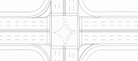
Supported output
RapidPlan supports CAD export to:
DWG,DXF.
What CAD export is for
Use CAD export when you need to:
- share a traffic control plan with CAD users,
- place RapidPlan output into a wider design drawing set,
- preserve georeferenced output for downstream spatial workflows,
- export either worksite drawing content or print-frame content.
Modelspace and paperspace
RapidPlan supports both:
- modelspace for the main drawing content,
- paperspace for print-frame based page layouts.
That means the exported file can represent either the site geometry itself, the prepared print layout, or both depending on how your plan is set up.
Export georeferenced CAD
Use georeferencing to keep exported CAD data aligned with its real-world location in CAD or GIS software.
To bring CAD data into RapidPlan, see Import georeferenced CAD.
Before you begin
- open or create a RapidPlan plan with a location and basemap,
- confirm the coordinate system required by the destination workflow. You may need its EPSG code.
Export a georeferenced print region
-
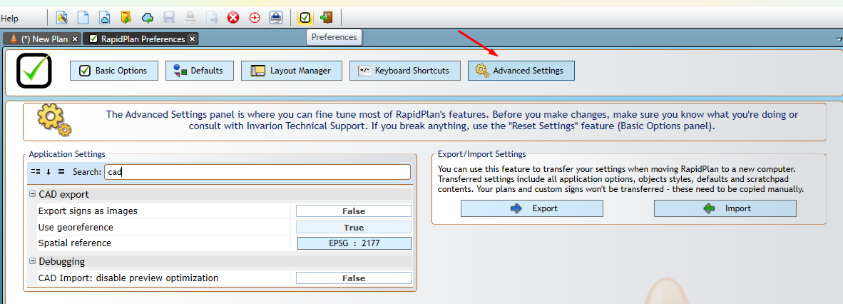
Open Preferences > Advanced Settings.
-
Under CAD export, set Use georeference to True.
-
Select Spatial reference, then choose the coordinate system required by the destination workflow.
-
Return to the plan and activate the required print region.
-
Right-click Print, then select Export this region and the CAD export option.
-
Choose the destination and save the export.
RapidPlan creates a CAD file and a matching .prj file containing the spatial reference. Keep both files in the same folder. If you import the CAD file into RapidPlan later, RapidPlan can use the .prj file to select its spatial reference automatically.
Export georeferenced CAD in a batch
- Open File > Export > Batch Export.
- Add the required open plans or plan files, then select the regions to export.
- Set Format to CAD and choose
DWGorDXF. - Optional: Select Export signs as image if signs should be rasterized in the CAD output.
- Select Use georeference.
- Select the spatial reference shown below Use georeference, then choose the required coordinate system.
- Select Export.
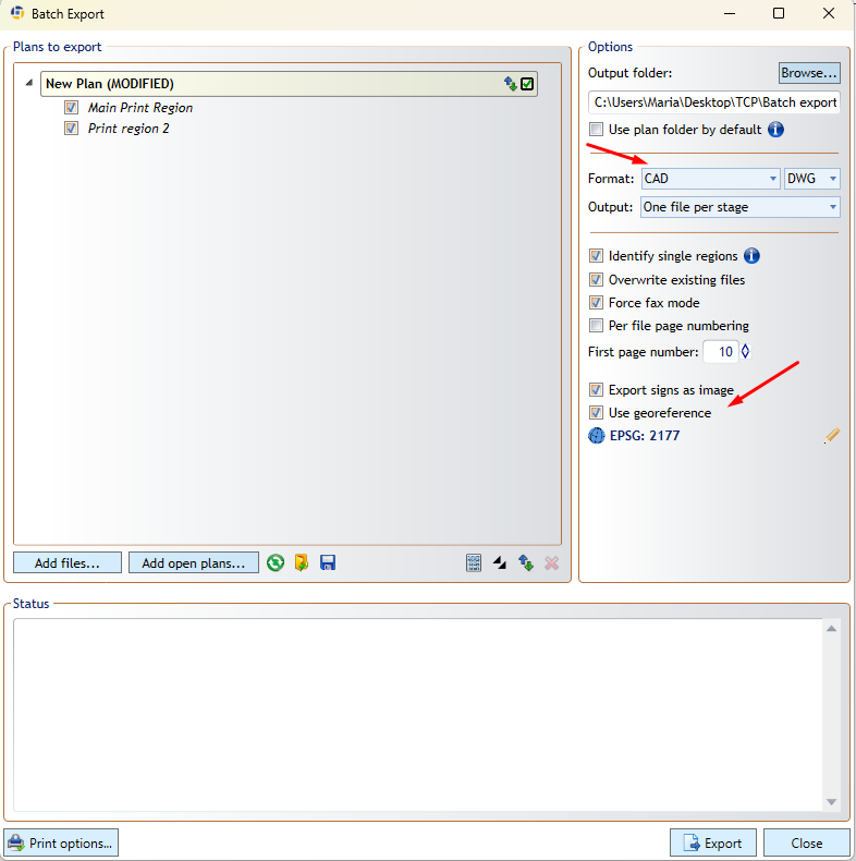
The exported CAD files use the selected spatial reference. Keep each generated .prj file with its matching CAD file.
When to use other export types instead
Use PDF or image export when you mainly need something to print, review, email, or attach to approvals.
Use CAD export when the recipient needs editable drawing data or spatially aligned output.