Tools palette overview
The Tools palette contains most of the tools you will use to construct the features of your plan.
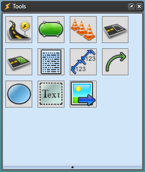
You can hover your mouse over each Tool to reveal its contents. Continue reading for more information on what each tool icon contains.
-
Roads - This displays each of the tools you can use to construct your road way.
See Drawing a road.
Roads 
Road 
Turn lane 
Arc road 
Roundabout 
Road corner 
Road region 
Intersection Editor -
Infrastructure - This displays infrastructure you may need to construct your plan including train tracks, bicycle lanes, etc.
See Road infrastructure tools.
Infrastructure 
Train tracks 
Crosswalk 
Island 
Bicycle lane 
Parking bay 
Sidewalk -
Devices - This displays devices such as delineators, arrow board and lane status.
See Delineators and the devices pages in this category.
Devices 
Delineator 
Buffered delineator 
Arrow board 
VMS board 
Lane status 
LUMS board 
Multi message sign -
Markings - This displays various lane markings.
See Road marking tools.
Markings 
Lane marker 
Flush median Chevron flush median 
Lane mask 
Road mask -
Zones - This includes a work area zone and a safety zone.
See Work Area and Safety Zone tools.
Zones 
Work area 
Safety zone -
Annotations - This includes necessary annotation features for your plan such as a scale marker and a legend box.
See the annotation pages in Devices, Markers and Annotations.
Annotations 
North Arrow 
Scale marker 
Legend box 
Manifest box 
Titlebox 
Number stamper 
Zoomed view box -
Markers - This displays distance markers, an area marker and an angle marker.
See Distance markers and Chainage markers.
Markers 
Distance marker 
Combined distance marker Offset distance marker 
Angle marker 
Area marker 
Combined offset distance marker -
Lines - This displays various line shapes that can be used.
See Line and shape tools.
Lines 
Polyline 
Spline 
Bezier 
Arc Arrow 
Marked path -
Shapes - These simple shape tools allow you to create your own objects and signs for your plans.
See Line and shape tools.
Shapes 
Rectangle 
Elipse Rounded rectangle 
Polygon 
Filled spline 
Filled Bezier 
Grid 
Arc pie 
Cloud Shape -
Text - These text options can allow you to add a text box, name roads, hyperlinks and create signs.
See Text tools.
Text 
Text object 
Text box 
Text pair 
Arrow text 
Callout box 
Path text 
Text table 
Hyperlink 
Rich Text -
Image - This allows you to open an image from your computer to your plan.
Image 
Import image