Integrated map providers
RapidPlan's mapping tools start with a Base Map plan. Once a plan has a location and scale, you can use live basemaps, import aerial photos, bring in road or GIS data, and use location-aware tools.
Create a base map plan
- Open the New Plan Wizard.
- Choose Base Map in step 1.
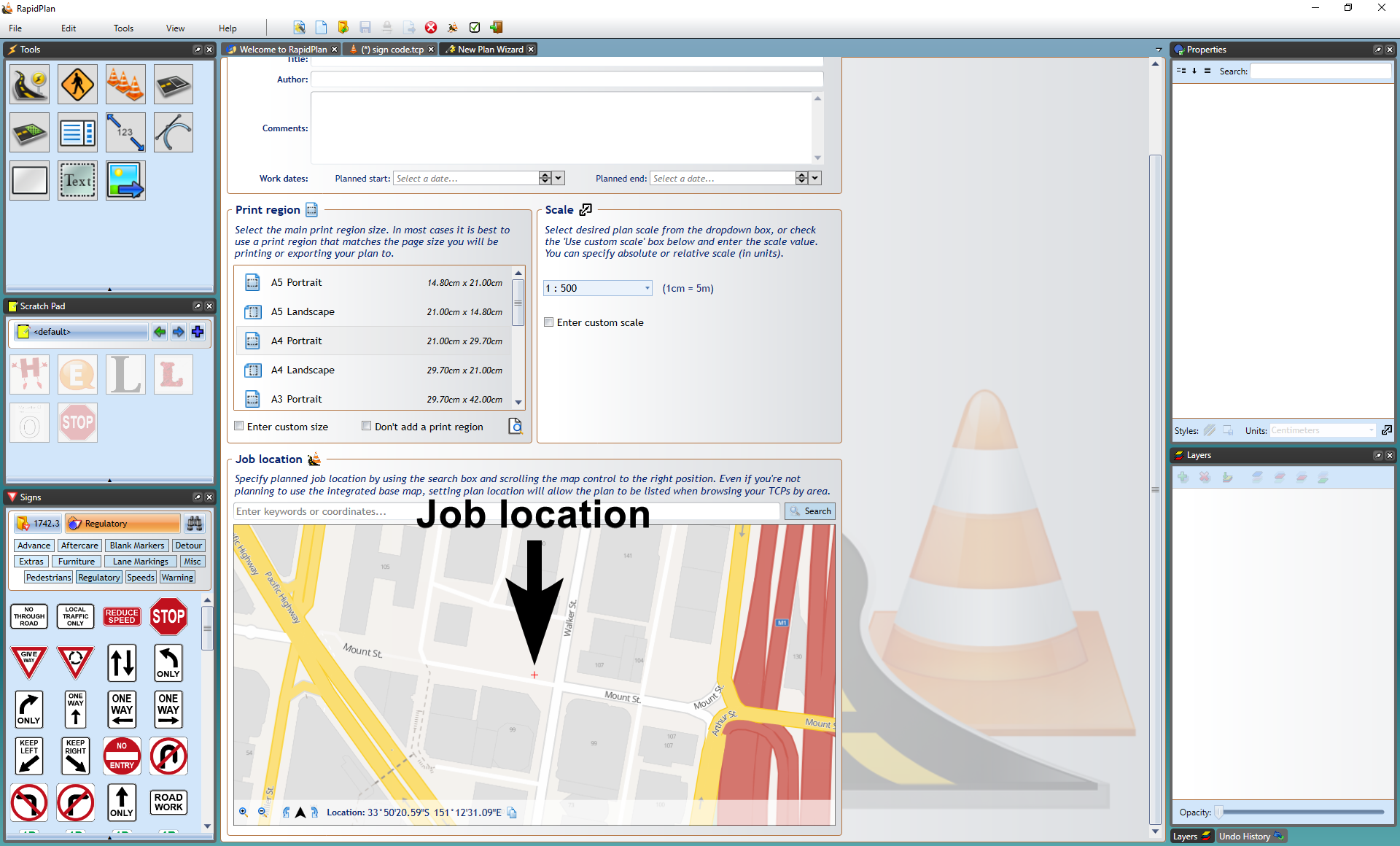
- Set a plan scale, then search for the job location by address, coordinates, or other supported location formats.
- Adjust the map so the red cross marks the location you want to start from.
- Select Create Plan.
Choose a provider
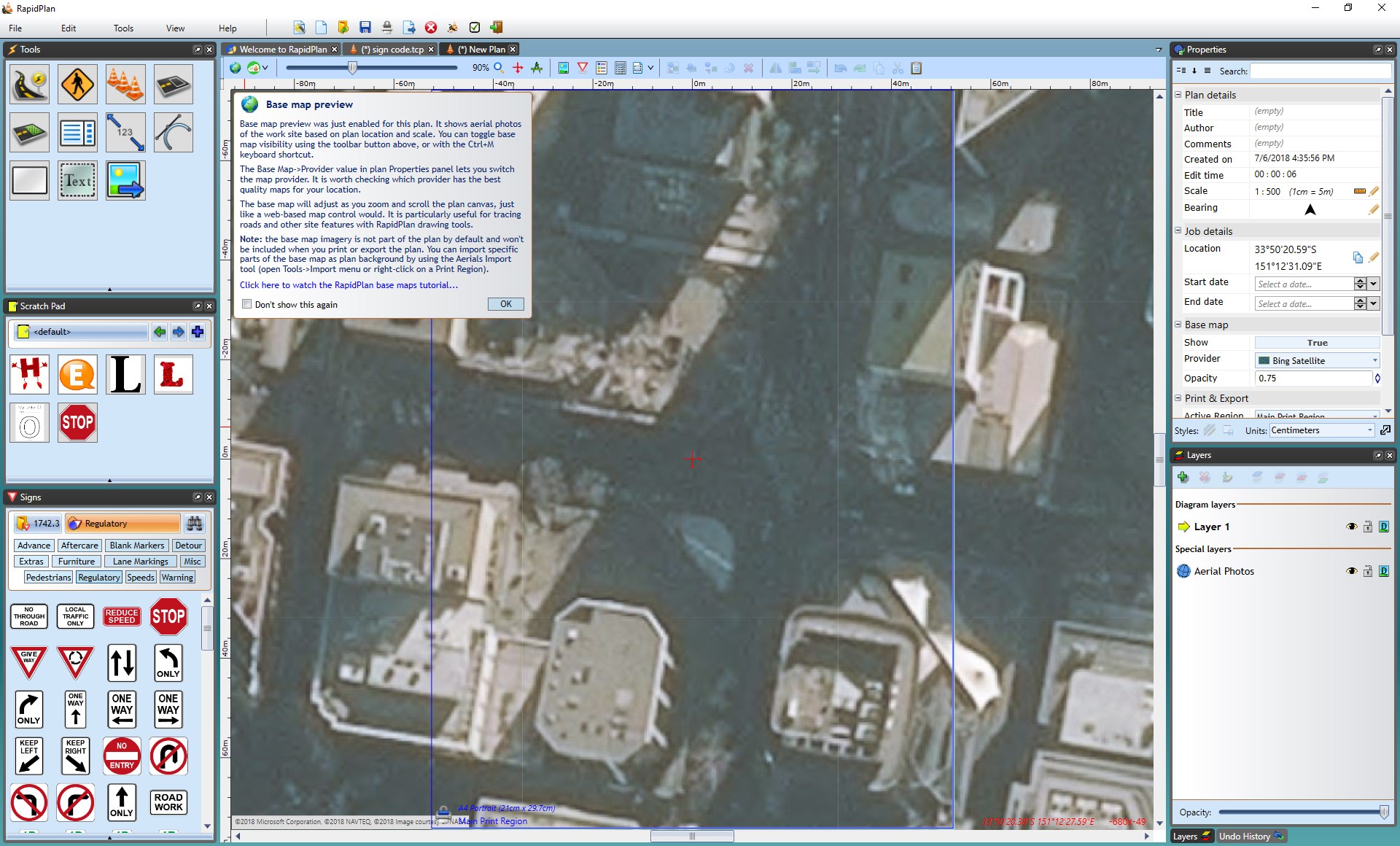
Use the Base map section in the Properties palette to:
- show or hide the basemap,
- change the provider,
- adjust the map opacity,
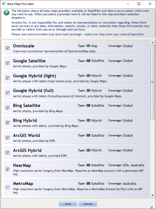
- open the provider list and enable additional providers.
RapidPlan includes global providers such as Google, Bing, and ArcGIS, plus regional and subscription-based providers that depend on your country version and connected services.
Google basemaps
Google is one of the main basemap options for current RapidPlan workflows:
- Google Roadmap is useful when you want road layout and labels,
- Google Satellite is useful when you need aerial context,
- Google annotations can be reduced or removed to keep the basemap clean while drawing.
In supported locations, the Google Roadmap provider can also show Road Level Details, including features such as lane markings, turn lanes, crossings, and curb detail when you zoom in far enough.
Google annotation levels
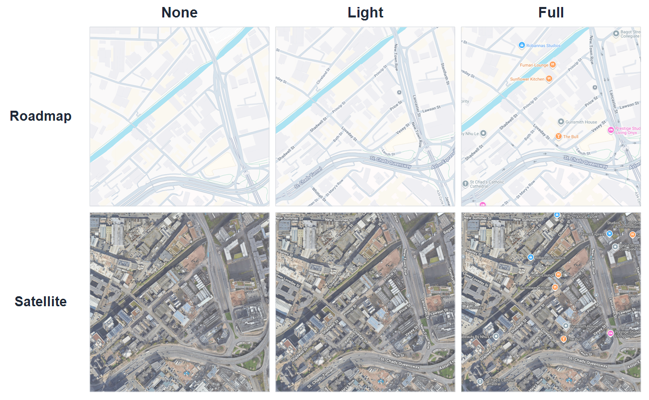
When you select Google Roadmap or Google Satellite, the Base map section includes an Annotations dropdown.
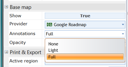
Use this setting to control how much Google map labeling appears on the basemap:
- None shows a clean map without road labels, points of interest, or place names,
- Light adds road labels and transport stops. With Google Satellite, this gives a satellite view with road labels, similar to the older Google Hybrid view,
- Full shows the full Google map labeling, including road labels, points of interest, and place names.
Additional providers
Depending on your region and subscriptions, you may also have access to providers such as:
- NearMap,
- MetroMap,
- government or regional imagery services,
- ArcGIS-based imagery services.
If a provider is not visible in the main dropdown, open More providers... and enable it there first.
Custom Service provider
RapidPlan also supports a Custom Service basemap provider for compatible tiled services.
Use it when you need to connect RapidPlan to:
- a WMTS service,
- an ArcGIS MapServer tile service.
To add one:
- Open the Provider dropdown in the Base map section.
- Select More providers... and enable Custom Service.
- Pick Custom Service from the provider list.
- Enter the service URL and, if required, an API key.
- Select Get Details and choose one of the detected compatible configurations.
Compatible custom basemap services need to use Web Mercator with a Google-compatible tiling scheme.
Using the map as a drawing reference
The live basemap preview is useful as a stencil while drawing. You can lower map opacity, trace roads or work areas over the background, and then turn the preview off when you want to check only the plan objects.
If you need the imagery to print or export, import aerial photos instead of relying on the live preview.
Related tasks
- use Spatial Data Import to bring in ArcGIS, CAD, KML, and Shapefile data,
- use Road import when you specifically want road geometry from OpenStreetMap data,
- use Aerial photo import when you need basemap imagery included in print or export output,
- use Georeferenced image import for already georeferenced map images,
- use Printing and export when you need output files.